Saturday, March 29, 2014

Black Hills Trip Report

Do not go gentle into the dark night that is the Grizzly Trail, No. 7.

I repeat, do not go gentle into the dark night that is Grizzly Trail, No. 7.

Having said that, the Black Hills are pretty wild. By far and away, the least scenic trip I've done in a while, but not every single hike can be all about deep canyons and sweeping scenery.

The Hills are tight, lots of trees, lots of rocks. It's easy to get hedged in, which is actually kind of comforting when it's -20 degrees FAHRENHEIT outside and you need lots of wind protection and also lots of firewood. The terrain, the trails and the general flora and fauna forcibly reminded me of the Appalachians, which means there are lots of trees and though the mountains lack sheer altitude of western counterparts, the trails that climb them make up the discrepancy in steepness, difficulty, soul-crushing false summits and general bitchiness.

Typical blaze
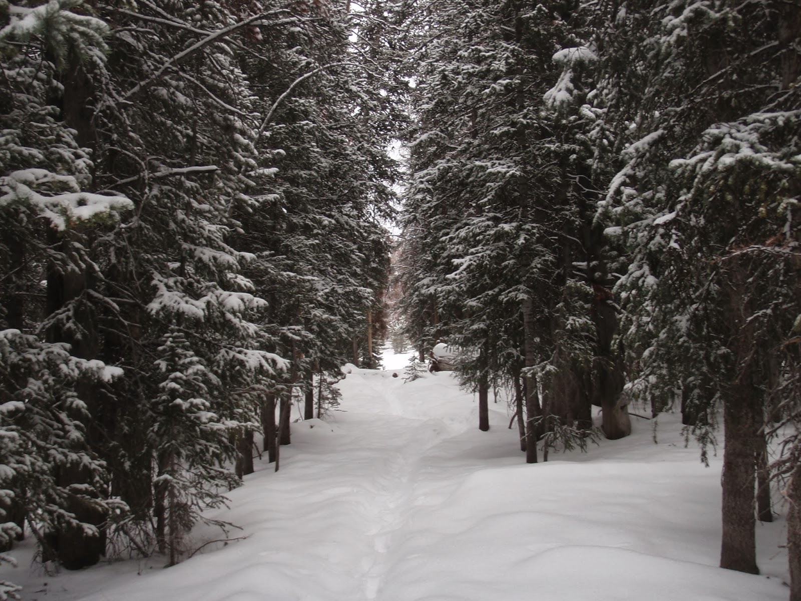
Although I will say that the Appalachians are much wetter, much warmer and better groomed because holy shit, Grizzly Trail No. 7 was a one way ticket to blowdown city, population my dumb ass. About 60% of my hike looked like this, minus the people and terrifying packbeasts. Probably would have had to gut out a crosscountry trip if the trails hadn't been suspiciously well blazed.... by far the most comprehensive marking system I've seen west of the Appalachian trail. Granted, like most western hiking trails, people shy away from using paint and instead gouge out super durable rectangles into tree bark, but the overall effect was the same; I only got turned around a few times, no mean feat in itself.

Campsite
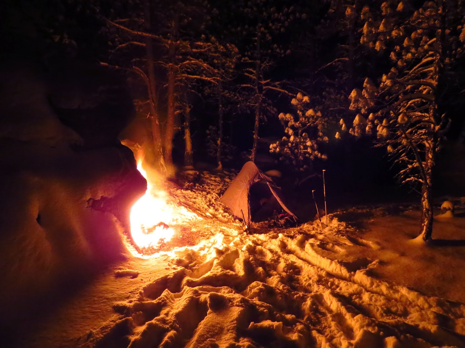
Anyway, pretty basic first day, I ended up overpacking by quite a bit because of the forecasted lows of -20.  Made a few miles, camped out on a hill and ran around setting up my camp as well as I could. Situated my fire against a rock wall so the heat would radiate out in one direction, cut a bunch of firewood, ate and went to bed after confronting a log that I thought was a cougar.

The next morning I got up to more below 0 temps, but the weather lacked the bite it had the day previous. Had to thaw out, then dry my sleeping bag at my morning fire (I actually brought a down bag for once.....see if I make that mistake ever again), then skipped into the lovely woods to enjoy a snowy, slightly less cold day of hiking. All went well until a long, steep uphill section of trail that was cut right next to a steep mountain stream. The trail and creek had formed a tight gully that ended up being a tree magnet for every dead pine that has ever fallen down in the history of the world and so I spend most of my day bushwacking and climbing up super steep hills, wondering whether or not my GPS was sadistic or just broken, because I thought that there was no way that I was standing 15 feet west of a real-live hiking trail. 

GPS turned out to be right the next morning, but the trail was so effectively buried under millions of beetled pines that it did no good to anyone. I spent an uneasy, but warm night camped out below a ridge and vowed to backtrack to known trail the next morning.

Tower view
Of course, I hate retracing my steps, and instead pushed on into the vast unknown until I ended up finding trail a ways into the morning, and kept on trucking through snow and more blowdowns until I came to a lookout tower, hung out and then started the long hike down to road level.

I decided to push for my truck from that lookout tower, as I was tired and sunburnt and wanted to go home, but the snow and, surprise, downed trees made for slow going. Ended up back at my Tacoma a little after dark, drove to Rapid City and had an expensive steak dinner.

Overall good trip, but one of the most difficult trips I've done in recent memory, between the constant bushwhacking, deep snow post-holing, extreme cold and heavy pack.  I try not to make my trips into a death march, but it's nice to push through limit testing trips like this one.


Video will be posted later, but I didn't have a whole lot of footage to work with. I find that when I have to work alot harder to make miles happpen, I don't take so many pictures or videos. Which is probably a good thing unless my viewers like 10 minute long monologues about how much I hate whatever is stopping me from being an effective hiker.


Thursday, February 27, 2014

Zion


So.

Everything is Zion National Park is pretty aptly named. Right off the main drag, you've got the majestic peaks that surround the river and the obligatory scenic roadway, where tourists (myself included) routinely slam on their brakes every twenty-five feet because would you look at that crow over there, have you ever seen anything so majestic honey quick get my tripod before he finishes trying to swallow that entire corndog.

Anyway, you drive into the park surrounded with beauty. You get the Court of the Patriarchs, The Great White Throne, Angel's Landing, the Emerald Pools, Weeping Rock. You get the Altar of Sacrifice, The Watchman, the Temple. For a meager entrance fee, you get to stand in the presence of the Mountain of Mystery, where it is said that if a man climbs to the top, he becomes wise beyond his years and decides to stop all this stupid backpacking shit and start sleeping at Holiday Inns like a regular human being.

Once you get to the backcountry though, that's where things start to shine. You'll find yourself looking at a gorgeous high desert landscape among such attractions as Telephone Canyon and Horse
Pasture Plateau. Who needs the Mountain of Mystery when you've got Potato Hollow?

I'll give the cartographer a break though, because by the time I hit the abovementioned hollow, I was hyperfocused on potatoes myself, albeit the instant, mashed variety. Horse Pasture Plateau was completely devoid of horses (thank god) and for all I know, Telephone Canyon
is home to vicious herds of Nokias and their close relatives, soup cans connected with strings.
Stupid Sunset


Came into Zion with plenty of time to hit my campsite by dark, but the climb up was stiff enough to be obscene and I stood around and took an hour and a half's worth of photos of the sunset. So I ended up nighthiking for 3 or 4 hours.

Met two other hikers camped out on a switchback a mile or so before the first designated campsite (yeah, Zion is one of those parks). The snowpack started to show up soon after that, but it honestly wasn't bad. A foot, maybe less. The worst part about it was the temperature, which, at canyon bottom was near 60, and up at elevation was around 35. Meant that the snow got warm enough to melt into your socks, but it wasn't warm enough to dry them once you stopped.


Anyway, got to campsite, set up and went to bed. Woke up, hiked on through snow and some surprisingly difficult terrain, ended up at an AWESOME campsite for the second night. Great views of the sunset and sunrise, was fairly warm and had plenty of rock stools
Campsite Sunset


Zion is, in a word, incredible. Without a doubt one of the most beautiful places I've ever hiked. It was so damn colorful and dramatic that words can hardly do it justice. I will be returning for sure, ha
d my eye on a few inaccessible "air islands" that I'm pretty sure no human has set foot on in decades, if ever. Spent 3 days in there, and I was already missing it on the hike out.


BAM HIT YOU WITH THE SUNRISE
H20 was definitely scarce, even with snowmelt occurring everywhere. The area, even with the snow, was one big fire hazard, so if you decide to shirk the rules and make a fire, make em small, safe and make sure they're completely out before heading on down the trail.

I got down into a couple of canyons, but for once decided not to push my luck. Smooth walls made getting out hard enough as it was, and I didn't want to get canyoned with a broken leg or something equally stupid.


Really is incredible.
Finally got to use my Gpsmap 62s to it's full potential (maybe not, but I'm getting a hell of a lot better). Added in some co-ordinates and played around with it, but have to say that I was only semi-impressed with the maps I downloaded (Bird's Eye Imagery). The map was scrunched and they made the West Rim Trail the same color as the  topographic lines. Springs were marked and overall I'm glad I had it, especially during the nighthike portion. Didn't really refer to it during the day at all, as I have found that reliance on physical evidence of trail is much more effective that reliance on maps and/or GPS devices. More on that later.


Here is a short list of things I'd have brought with me if given the chance. Note that they are system and season specific.

1. Climbing gear/Rope/Carabiners
2. Gaiters
3. Waterproof shoes
4. 2 Extra Pair of Socks
5. Extra memory card for camera
6. More time
7. Spork.

I'd like to take a moment to note that my titanium spork, a particularly fine specimen from the good people at Vargo, has spent the last 3 trips in the bed of my truck, completely unused. I had lost it until recently and have been forced to whittle my own utensils like Dick Proenneke or, even worse, use plebian cutlery in lieu of specialized gear. Protip of the day: Spoons work just fine.

Video is here

Pictures are here and here


Saturday, January 25, 2014

Medicine Bow

So this was my first trip out in a while, been working and also traveling to cities instead of wilderness destinations.

Definitely needed this one, was missing backpacking pretty hard. Just a quick overnighter to the giant and complex Medicine Bow National Forest. Pretty short mileage, pretty mild weather except for the crazy winds. Trail was overgrown with snow drifts so I stopped following it almost immediately, instead just jumped up on a corniced ridge and took in the scenery for a while. Got a little weird (read cold and tired) due to the wind, so I walked back down. Did not attempt any glissades due to a lack of ice axeage.

Night was really windy and cold, had to actually go through the trouble of putting guy lines out. Woke up and walked back out to get back to work by the next day.

Will definitely be back, was great. Only wish I had more time or put down more miles, but winter backpacking always kind of hobbles the hiker in terms of distance covered.

Video is here.

ALSO since I got a new camera, I got a flickr too. You can check out the best of my decidedly amateur best here.


Saturday, December 7, 2013

Elkhart

SO, my 99 camry toasted its tranny coming back from Glacier National Park, and wasn't back from the shop by the time I got off work 16 days later.

Undaunted, I decided to visit the local Pinedale thriftstore and purchase a brand spanking new-to-me deathtrap disguised as an old ten-speed road bike and ride on up to the Wind River Range. My plan was to ride up, hike in and spend 2 nights in the Bridger-Teton Wilderness area, then ride back to a hotel room and hamburgers.

Grabbed a bike pump and a flat kit so I wouldn't have to walk or ride the rims back to Pinedale if the tires went, picked up a map at the ranger station in town and rolled on out (up).

2000 vertical feet, 16 miles and 3 hours later I finally topped out at the Elkhart Ranger Station. I had to walk the last couple miles of the route because it was pitch black, there was some snow on the road and also because my legs had some mysterious mechanical issue that prevented them from pedaling any farther up the climb. I've noticed this phenomenon before on previous rides, and have begun documenting all further occurrences so that modern science can work out what exactly is the goddamn problem with my quads.

Set my tent up at the car-camping site, next to an horseman/elk hunter who was planning on going out with his buddy the next morning and setting up a basecamp at a lake about 5-10 miles from the trailhead. I was planning on making a long loop around the wilderness that passed by that same lake on the return trip, so I told them ttyl and left.

Well, it got snowy pretty quickly,
followed some cross-country ski blazes to my trail a ways into the wilderness. Wandered around a bit, saw a snow bunny and decided to get back on track and met up with two lady day-hikers at lunch. Had a brief convergence as the elk hunters showed up there too and took a side trail down the lake. I went on my way after I fed some mashed potatoes to these snow-birds that kept on bugging me.


Anyway, I followed the day hiker's tracks up the trail until they turned back around, and from then on the going got a little slower. Lots of snow pack, scarce trail sign and cold feet because I brought my normal hiking shoes and also I forgot my gaiters again. AGAIN. Kept pushing on, and got to my destination early, so I took a side spur and ended up next to this beautiful lake with a great view


Had a pretty easy time with the fire, got set up with the back and side of my tent on a cliff in order to minimize the directions from which I could be attacked by cougars or bears. With a fire on the right, and sheer cliff to my left and rear flanks, any offensive maneuver by an enemy force will be a head-on one, which means I have a much better chance of successfully defending my body and belongings from a savage mauling. This aspect of campsite management is an oft-ignored one, and I'm hoping that my dissertation (complete with schematics) on the subject will receive long overdue appreciation and publication in a nationally syndicated magazine. Personally, I'm hoping for National Geographic or Outside, but am willing to settle for Backpacker.


Got up the next morning to frozen shoes, but I had been using my brand new Black Diamond Mercury Mitts as booties during the cold nights, so I just walked around the snow in them to get a fire going. Thawed out my main kicks and got back on the trail to get to the intriguing small black X on my map. Photographer's Point might be aptly named, or it might not exist at all. Fuck if I know, I never did end up finding it. 


I surmised the previous day that the spot, located well off the main trail, would offer some really nice photo ops of Long Lake and the surrounding mountain peaks. I had thought about trying to get there on the first day, but decided due to weaning light, snowpack and a general unfamiliarity with the area to postpone the trip out there until the second day arrived.

SO, when I woke up and got my frozen shoes unfrozen, I started bushwhacking due west, and soon found myself at a sheer cliff wall that dropped down to a frozen, snowy creek. 
I may have mentioned before on this blog or IRL that I am an idiot of the highest caliber, and so many of you will find it unsurprising that I attempted a sketchy, crumbly descent of this cliff face rather than finding an alternate route. At the bottom of this cliff, I found a another problem that I had never faced before-the gully was lined with huge to large boulders, and the snowpack was deep enough to engulf all but the most massive. Unfortunately, the snowpack was also light and powerdery, so It made traversing the rock gardens inherently dangerous, as I couldn’t tell at which points I was stepping on solid rock or about to fall down into a crevice. I basically ended up army-crawling across this minefield to get to the opposite side and where I assumed Photographer’s Point would be.

Long story short, I postholed my way across a mile of snow before re-evaluating my short and long term goals for the trip and deciding that I didn’t give a shit about Photographer’s Point, I had a crappy camera and I wanted to get back to the trail.

It was about then that I discovered that my map, located securely in one of my many pockets, had taken its leave of me. I think I remember it saying something about heading to the store for a pack of smokes, but I really wasn't listening. Good riddance, probably.


Fortunately, the loop I planned was simple and I remembered enough of the map to make little snow-maps of where I thought I was and where I thought the trail ran. About two hours later, I stumbled across the trail, about .5 miles from where I expected I would hit it. Was still very pleased with the result, because I had not been relishing the idea of my “Plan C” which involved the necessary evils of rationing food and walking at least 20 miles of west by southwest crosscountry back to Pinedale.


It was here I made the decision to descend south along 3 large lakes to follow my preplanned route instead of backtracking along the previous days tracks. I figured that I wanted to take the risk, even mapless, and if things got bad on the southward road, I could just follow my tracks back to the trail again and then head back to my bicycle and pizza.

Ended up finding the trail very easily once I dropped down in elevation a little bit, and followed it for a couple sunny miles before I hit a snag, namely a snowed over canyon with only uncharacteristically ancient trail-sign and no clear way to proceed. Wasn’t sure it was right, so I snacked on some trail mix and thought about what to do when I heard the neighing of a horse. I initially thought it might be some kind of weird Wyoming bird and ignored it, but eventually I decided to follow the sound out of the canyon and onto the banks of the lake where the elk hunters had set up a sweet, and I mean SWEET basecamp.

Big canvas tent, potbelly stove, the works. The two men weren’t there, when I arrived, as they had ridden back to their trucks in order to find a lost stovepipe. I hung out with the remaining horses for a little bit, then set up my tent on a nearby rock that jutted out into the lake.

LOOK
Got a fire going and found what may be the best spring I have ever come across ever. Definitely in my top 10 water sources of all time.  A few feet below it, there was another less cool but still awesome waterfall that I was initially going to fill up at, but in between the two there was a metric ton of elk poop. Elks couldn’t ruin the AMAZING spring (I went upstream to check) but they did manage to soil the lower one. 


Just Look
As an aside, Trashbag Nation would like to congratulate Elks for edging out Buffalo to make it into the top 5 additions to our animal shitlist. They now join their esteemed colleagues; horses, horses, bears and mosquitoes.

When the elk hunters came back from their fruitless search, I shot the shit with them around their fire before retiring to my campsite to dry out my shoes again and go to bed.

Snowstorm came that night and dumped a good 4 inches on everybody by the following morning, so I woke up and packed out in a hurry. I had found a pair of shredded and abandoned pants on a bush the previous night, and butchered them in order to make a pair of gaiters that ended up working really well.

I followed the horse tracks back out for as long as I could, but the snow killed most of them off before I had knocked out a mile or two. Thankfully, I had already hiked this section of trail to get into the park and knew my way out. Had a extremely pleasant little walk out, got back to my bike (tires filled and not stolen!) and had a extremely terrifying ride back down to town. Sections of the road were iced and then snowed over, and my braking system left a lot to be desired which means that the brakes didn’t work and I basically white-knuckled my way down to dry pavement.

Still, had a great time, got some great pictures and got a few good stories out the trip, which is usually the whole point in the first place.

Videos about it are here and also here